Automatic vegetation detection for Infrabel
Kapernikov has developed a method to detect vegetation overgrowth alongside Belgium’s railway trac ...


Machine vision
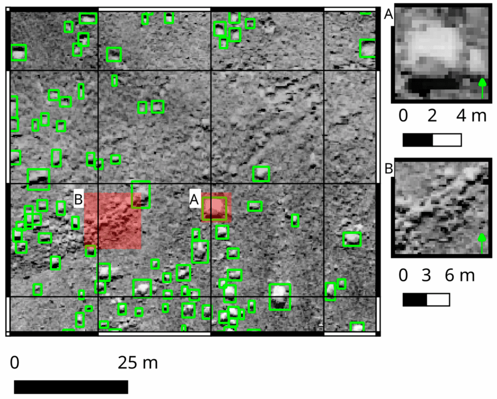
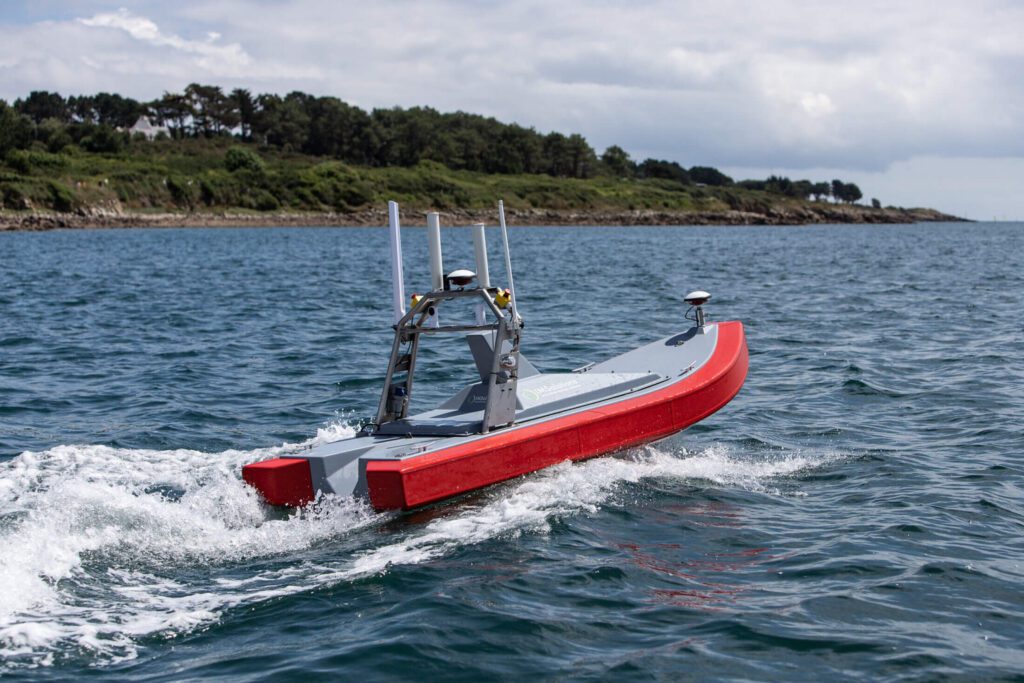
Maritime infrastructure projects depend on accurate and timely insights from survey data. Every day, GEOxyz collects vast amounts of raw data at sea: seabed profiles, side-scan sonar, magnetometry, and sub-bottom inspections.
Traditionally, processing this data has been repetitive and time-consuming. As survey demand grows and datasets expand, the pressure on these highly specialized teams increases. GEOxyz needed a way to scale operations without compromising quality.
“People should be able to focus on interesting and challenging work. That’s why A.I. is the right tool for us.”
— Jan Catrysse, CTO at GEOxyz
GEOxyz teamed up with Kapernikov to integrate artificial intelligence into the core of survey operations. The collaboration centers on two key strategies:
By bringing a decade of A.I. and deep learning experience on board, GEOxyz ensures that they do not have to learn the hard way. Kapernikov is a team of experts on a mission to learn to fish in the technical domain of data and AI.
The operational improvements will not only affect GEOxyz’s position in the global maritime market. The wider Belgian maritime ecosystem – with international presence – will benefit from the speed, quality, and precision in competitive international tenders.